
Click the above image for the gallery on flickr cause the embed options all suck. Also all images are captioned with additional information not always included below
This flight was flown earlier this week after a few days delay due to scheduling conflicts. This was actually a good thing because it turns out two of the lighthouse models that were supposed to have been updated with rotating lights had not been properly updated and still showed up with just static spill lights on the buildings themselves. I found this out Sunday the day before we were supposed to fly and attempted to contact the author. He finally responded Wed afternoon and uploaded the new files so we were able to install them just as we loaded up the sim that night.
After we couldn’t fly on Monday as planned we were forced to wait until Wed for weather to improve again. For keeping an eye on this I used meteoblue’s forecasts since that is the company partnered with Asobo to produce the live inflight weather data. I chose several points along our planned route and saved an image of each forecast then layered them to see how much cloud cover overall we would experience along the way. The image I linked to shows 3 flight windows on Mon, Tue and Wed. Slightly better than Mon cloud-wise Wed was a bit windier and also colder (air temp chart was higher up). Regardless clouds were the main issue because without moisture flying in the cold isn’t so bad. I was hoping there would be enough breaks in the 10-25% cloud cover to avoid them altogether, knowing later in the flight we would have to climb up to above 4,000′.
So we are sitting on the tarmac at Cape May County (KWWD) getting ready for departure when all the sudden I start to hear…. I’m like to my friend Andrew – “is that fucking rain??” I turn on my cockpit flashlight and sure enough rain drops are spattering my windows. This despite the weather looking perfectly good earlier and nothing on the radar when I check meteoblue. So that was an oddly annoying decision by the game’s weather engine but I wasn’t also too concerned because I knew conditions could improve as expected as we headed north and cold temperatures were not yet an issue since we would be flying low over the ocean.
When I went to start my engine however after completing my pre-start checks it failed to turn over and I couldn’t figure out why. We were already running a bit late, Andrew had already taxied to the runway hold short so I threw a bit of realism out the window and just restarted the flight on the runway so everything would be set and ready to go. Well, almost I had to reset my nav and comm radios and after taking off Andrew reminded me I had to set my altimeter as well. Departure was almost into the wind from Rwy28 but even with just a slight crosswind it was coming at us around 15-20kts and so like last flight I had to give it a bit of aileron in addition to rudder to keep on the runway.
Once airborne I banked left over the shore to swing down past the tip of Cape May to scope out the lighthouse before continuing to work around back to the north. Unfortunately despite downloading and installing the updated files for it, it still showed up with a static spill light directed on it, no actual rotating beacon. At least it was there though to serve as a landmark, and I continued on northwards with Andrew joining up on my wing. Since he was in the faster 172 I was in lead as he could keep up with me easier. I had tuned my Nav1 to Atlantic City’s VOR just so I could check it was functioning properly for later in the flight and got a good signal and beacon code.
We headed up the shore, keeping low and over the water around 700′ as the clouds and light rain continued to encroach from not too much higher above. Thankfully though as we passed Ocean City roughly halfway from Cape May to Atlantic City conditions improved, good visibility came back and the rain tapered off. We stayed low to get a good look at Atlantic City all lit up as we cruised by and continued north towards our next VFR waypoint, the lighthouse that sits at Barnegat Inlet. Sadly this one too, which was supposed to have been properly updated this time, showed up with only a static spill light on it.
By the time we approached Sandy Hook just over an hour into the flight, we had climbed to around 1,200′ (FL12) as transition through the NYC SFRA would require an altitude between FL10 and FL13. Staying out over the water to the east as we passed by to avoid overflight of the national recreational area that Sandy Hook is, this time we finally got to see a proper lighthouse – or at least I did. Andrew says it never even loaded in for him. This lighthouse’s operation showed the rotating light but due to limitations in MSFS’ light system you couldn’t actually see the beacon light point itself from as far away as we were, just the spill rotating along the ground. So, better but still needs some work.
Right then, onto the SFRA, which we have already transited both ways several times on previous flights. It’s just the most convenient way to get through the busy NYC Bravo airspace without having to talk to ATC, which in MSFS is still buggy and pretty basic. We had a few new scenery enhancements loaded up to portray NYC at night so that looked great and a specific item in the flight plan reminded us to flip off Trump Tower as we flew past midtown. (I’m not affiliated with any political party I just consider Trump to be a horrible human being).
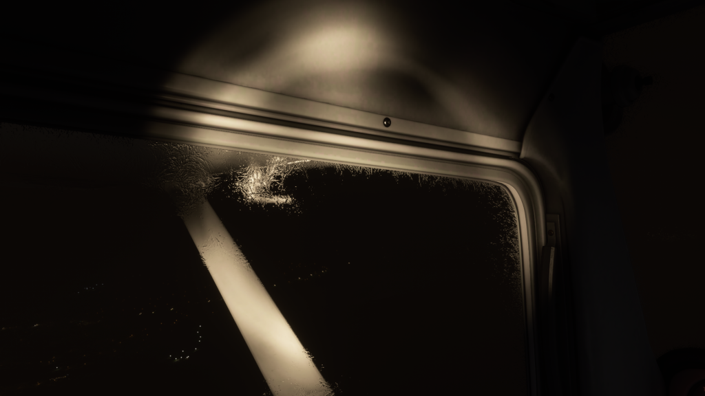
Once we flew out from under the floor of the NYC Bravo airspace about 1.5 hours into the flight we were clear to begin climbing as along the Hudson further north were two Class D airspaces we wanted to fly over which topped out at FL27. I could see there was a solid layer of clouds above but how high I couldn’t tell. I was hoping the clouds were closer to FL40 but I had only gotten up to FL17 before the lights below started to fade out. By FL20 though I could see them better again so I figured it was just a haze layer we could climb above. Continuing upwards my Nav2 OBI (which I wasn’t using) lit up with a VOR acquisition and for some reason that annoyed me so I swapped frequencies and it still caught a beacon so I randomly changed the standby frequency, swapped again and it still lit up. So I sighed and returned my attention to flying but I actually should have never taken my attention away from flying to fiddle around like that for a stupid reason because I suddenly realized I couldn’t see any ground lights out the front anymore. Looking to the side I saw a few but then I also saw the rim of my window was iced up. My cockpit lighting was not good enough to really see icing without my flashlight and when I clicked it on and saw the extent of the icing I immediately cut throttle and told Andrew I was descending.
I panicked a little, I will admit. I really couldn’t tell through the ice on my window if I was getting ice also on my airframe, and it was too dark to check even in external view especially with the majority of my plane painted white. So I oversped a bit dropping down and became slightly disoriented but managed to not smash into the ground. Once down below FL10 I saw that it wasn’t getting any worse but then again it also wasn’t getting any better. Despite my cabin heat being full open I couldn’t seem to melt the ice off my windshield, at least not entirely. I was definitely able to see just fine, and I felt no diminishing of my aircraft’s handling or performance. So I made the decision to carry on, keeping low over the Hudson to hope the ice would all eventually melt away.
This meant we had to call in to ATC at Hudson Valley Regional (KPOU) to request airspace transition, which I was hoping wouldn’t lock up my ATC window like it did the last time I had to do this. In this case though we transited in and out of the airspace with no issue, continuing up the river towards Albany. I actually started to find it very difficult to pick out the river in the dark despite the fact that it was surrounded by roads and towns. There was a gibbous Moon out but it was mostly shrouded by clouds and not shining down that brightly anyways to reflect off the water.
We continued north, and were able to eventually make it as high as FL20 without any problems with additional icing or clouds. A few aircraft were nearby and we made sure to call out visual sightings to ensure we both saw them. Cruuuiiiissssing right along. I did hear Andrew telling me he was climbing slow up to FL20 and took a while to get there after I did in his more powerful aircraft but I thought he was just being slow to keep pace with me so I didn’t really think too much about it.
At the point where we had to intercept a radial towards the Cambridge VOR and turn off the river over land, we had to climb back up and try to get above FL41 as that was the minimum altitude for obstacle avoidance in this area of the VFR chart. The clouds were broken now and you could see stars and the clouds looked pretty high, but I only got to FL27 before I saw the ice creeping back onto my windows. The air temperature was just too cold and the original ice from before still hadn’t melted away either. So it was another descent, much better managed this time, and time to consider diverting. A review of the charts though showed we could still proceed forward through Albany airspace and remain low. Dropping back down to FL10 again stopped the icing so we continued onward.
As we approached the airspace around Albany about 2.5hrs into the flight the amount of lights on the ground understandably increased but this actually made things worse for me because it was scattered by the ice on my windshield and practically blinded me from seeing clearly ahead. This was then compounded as we got closer by low clouds over Albany completely blocking our way and finally I had no choice but to tell Andrew we had to divert. I immediately banked around towards the south before we reached Albany airspace but the act of doing so got me really disoriented because of how poorly I could see out the window. Andrew’s 172 has a GPS so he took the lead to guide us to an alternate airport. As I swung around to follow him I realized we were heading northeast and was like “uhmm… where are we going?”. He had chosen an airport further from the river and at a higher altitude, which I immediately disapproved of and told him we need to turn around and head for Columbia County (1B1), which was near the river almost at sea level. I got my compass on a south-westerly course so I would eventually find the river again, then we could just follow it south until we spotted 1B1.
I was still having issues seeing very well so I again relied on Andrew to tell me when we were nearing the river, over the river, and when he could spot the airport on his GPS as the map scrolled along. I heard him call out the direction once we were close enough but looking that way I couldn’t make it out through the ice scatter and it took a few minutes to get closer before the lights were recognizable as an airport. Finally the beacon kicked in (some very weird short view distance settings on some of these game objects) and I could see exactly where the airport was. Left traffic pattern meant we could fly along the river on downwind then turn left onto base and again onto final. I went in first and you can see the landing on this video.
We both made it down okay, although Andrew commented on not having the greatest landing when touching down after me. After parking we got a good look at his aircraft under one of the airport lights and wow it was iced up pretty good, which would explain his performance issues! He had told me also during the flight he saw ice on his wing struts but never mentioned ice on his wings and said after we landed that from the bottoms they looked okay. So he was very unaware of how bad his aircraft was although the handling issues he was experiencing should have tipped him off – I probably should have wondered a bit more at the trouble he was having but again, it sounded more like he was just trying to fly slow to stay on pace with me! Anyways it’s not only a good thing I got us down quick but that I didn’t let him attempt to take us to an airport at a higher altitude.
I also want to note that after turning away from Albany I did not go into external view at any point. I wanted to really feel the pressure of the situation I was in, having trouble seeing out my windows while trying to regain my orientation and find the airport I had to get to. I wanted to see if I would experience any spatial disorientation, which coupled with icing can have deadly consequences. Very happy I managed to not crash! Also, even if Andrew had used external view it would have been too dark to see the amount of icing that had built up on his airframe.
Finally, an interesting thing happened to me upon landing – my lights cut out. I soon realized it was linked to my alternator, which wasn’t putting out enough energy if I cut throttle to idle below 1,000 RPM. Never seen this before but it makes sense if it’s so cold my battery drained and doesn’t recharge. Or something.
This was our longest continuous flight so far at just over 3hrs and 300nm. This was also the first time since restarting flight simming that I used a VOR navaid and it was nice to see I remembered how to do it, even if we ended up not needing it.
Anywhoo, we failed to make our destination of Saratoga County (5B2) and plan to make the remainder of the hop at a later date. From there we will hop back into our Cubs and head out over the Adirondacks for some bush flying – hopefully with snow!
mobile slots no deposit bonus usa, online casino no deposit bonus free
spins usa and best online is commerce casino open now usa 2021,
or bet365 united statesn roulette betting
Информация об обращении не передается третьим лицам а детали лечения обсуждаются только с пациентом. Исследовать вопрос подробнее – нарколог вывод из запоя в стационаре в геленджике
Помощь может включать консультацию детоксикацию стационар и дальнейшее сопровождение по показаниям. Подробнее можно узнать тут – наркология вывод из запоя
Мы понимаем что решение лечиться дается трудно: человек может бояться больничной обстановки родственники переживают за близкого а сам больной часто не верит что сможет выйти из запоя без очередного употребления спиртных напитков. Наркологическая помощь в стационаре — это шанс прервать замкнутый круг и сделать первый шаг к восстановлению. Важно не ждать пока состояние станет критическим: запой опасен обезвоживанием аритмии судорогами белой горячкой инфарктом инсультом и тяжелыми нарушениями работы мозга. Ознакомиться с деталями – вывод из запоя в стационаре клиника
sports cod Esports betting
sites that accept paypal